Rural Water &
ICT Convergence
LAB.
 go to facebook page
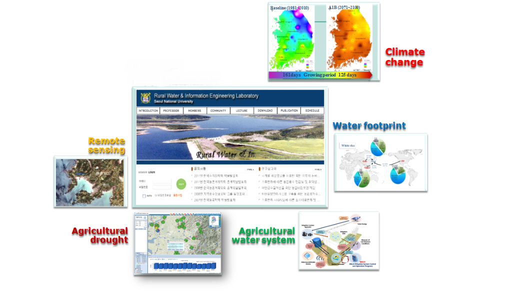
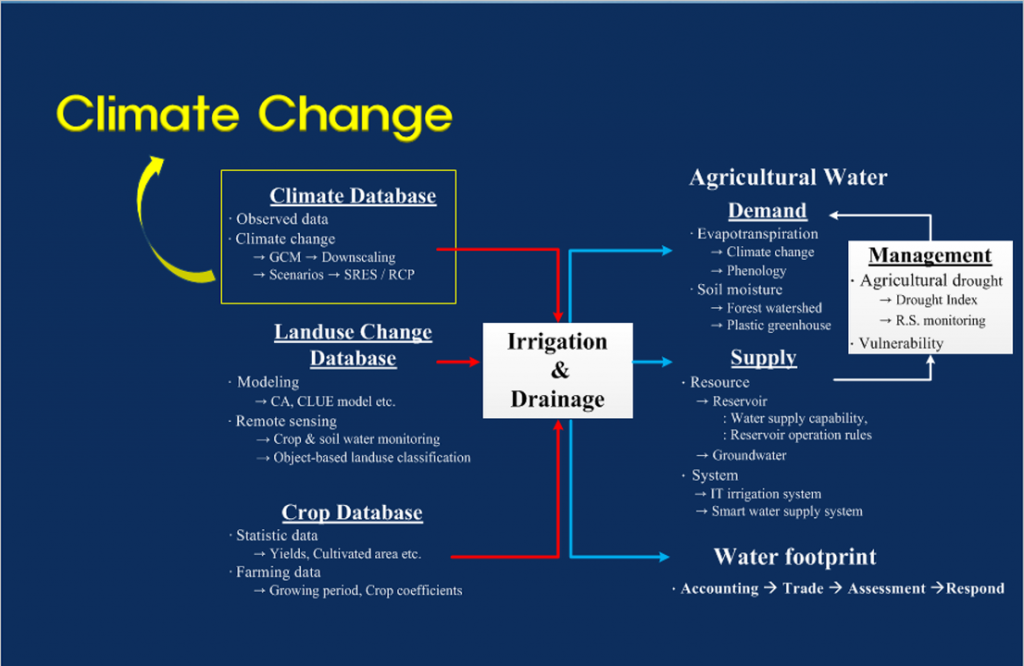
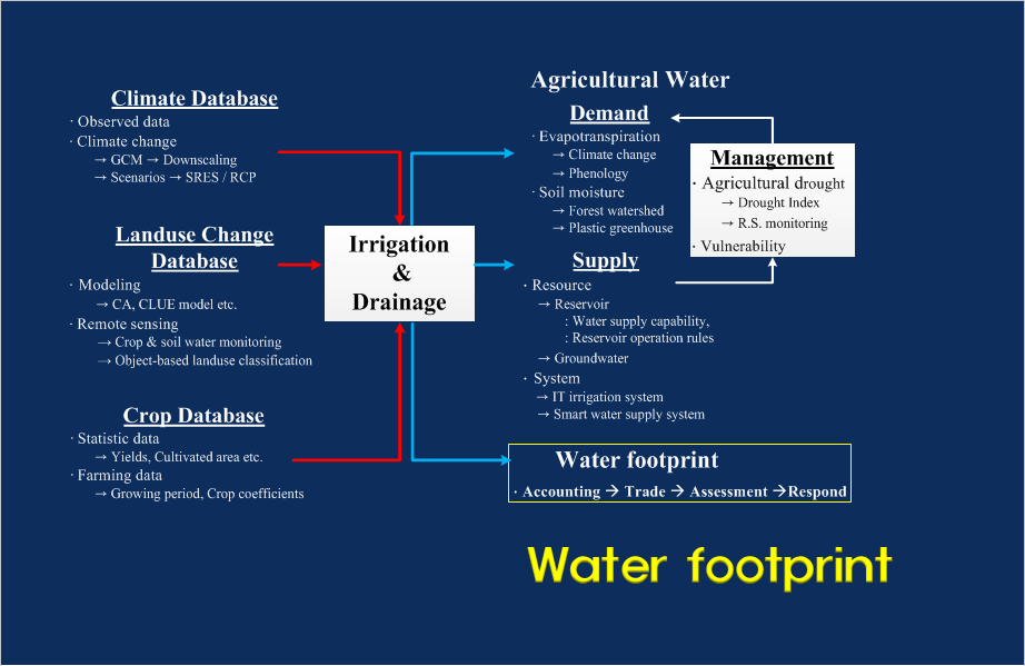
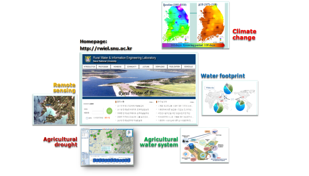
Climate Change & Agricultural Water
Assessment of uncertainty in future weather data
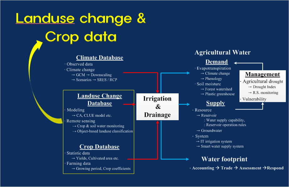
Effect analysis of climate change on landuse change and crop data
Vulnerability assessment of agricultural water by climate change
Proposal for agricultural water index in irrigation reservoirs
Proposal for vulnerability management of agricultural water
Study on Land Cover Using Satellite Imagery
Characteristics of land cover in hard approach area(North Korea, etc)
Applications to estimation of agricultural water by results at paddy field
Characteristics of land cover in large area
Availability of satellite imagery(arirang, etc) is becoming effective and it enables animated study on land cover extract, etc
Vulnerability Assessment of Water Supply Capacity
Vulnerability assessment in reliability analysis methods
Quantitative characteristics of water supply capacity in irrigation period
Effective operation and management of reservoirs
Development for automatic irrigation management program
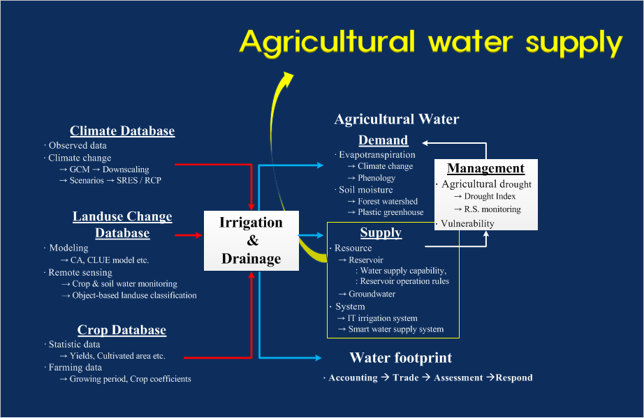
Development for web and GIS-based drought management system
Proposal for drought index and forecast for agricultural water management
Analysis of real-time water level
Development for web based agricultural water drought management and response system
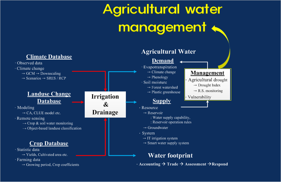
Estimation of water footprint

